CRFS simulation tools allow new users to be trained to use RFeye geolocation software in realistic scenarios without requiring real transmitters or receivers to be set up (especially important if wishing to test a scenario involving unlicensed spectrum use without breaking the law yourself!). Our simulation tools allow a network of simulated receivers and transmitters to perform spectrum monitoring tasks just like a real network.
Parameters such as transmitter frequency and modulation, receiver noise figure and sweep rate can all be easily adjusted in the simulation allowing fully flexible training scenarios. The use of elevation models such as SRTM and LIDAR ensures the effects of terrain and building obstacles are included in simulations of signal propagation.
The trainer can set up a network of receivers and transmitters with trainees connecting to the simulated receivers from their laptops over TCP/IP connections – just like connecting to a real Node. This means the trainees won’t be able to see simulated transmitters and instead will have to make use of RFeye geolocation tools to find them. This allows the trainer to truly test the trainees’ capabilities.
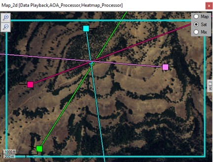
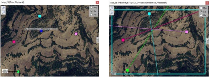
The images below show how this would work with the trainer version of the geolocation software on the left showing the simulated transmitter location and the trainee version on the right showing the transmitter successfully being located using the AOA geolocation tool.
This training can be desk-based with the trainees recording the GPS coordinates of where they think the transmitters are located. Alternatively, it can be carried out in the field with trainees attempting to navigate to the real-world location of the transmitter either on foot or by vehicle.
Simulated transmitters and receivers can even be made to move, either along predetermined tracks or by following the location of a trainee’s vehicle or cell phone. A common scenario would be to have a simulated receiver tracking a trainee’s vehicle GPS coordinates allowing Cumulative Tracking with a Direction Finding (DF) vehicle to be simulated. You could even have a scenario with one simulated transmitter following a trainee’s cell phone location with the remainder of the trainee group attempting to find them.
Existing users within your organisation can easily set up simulated scenarios like this to train new users or CRFS can provide training packages.