RFeye Mission Manager software
Automated spectrum monitoring
& mission management


Smart sweeps, scans & surveys
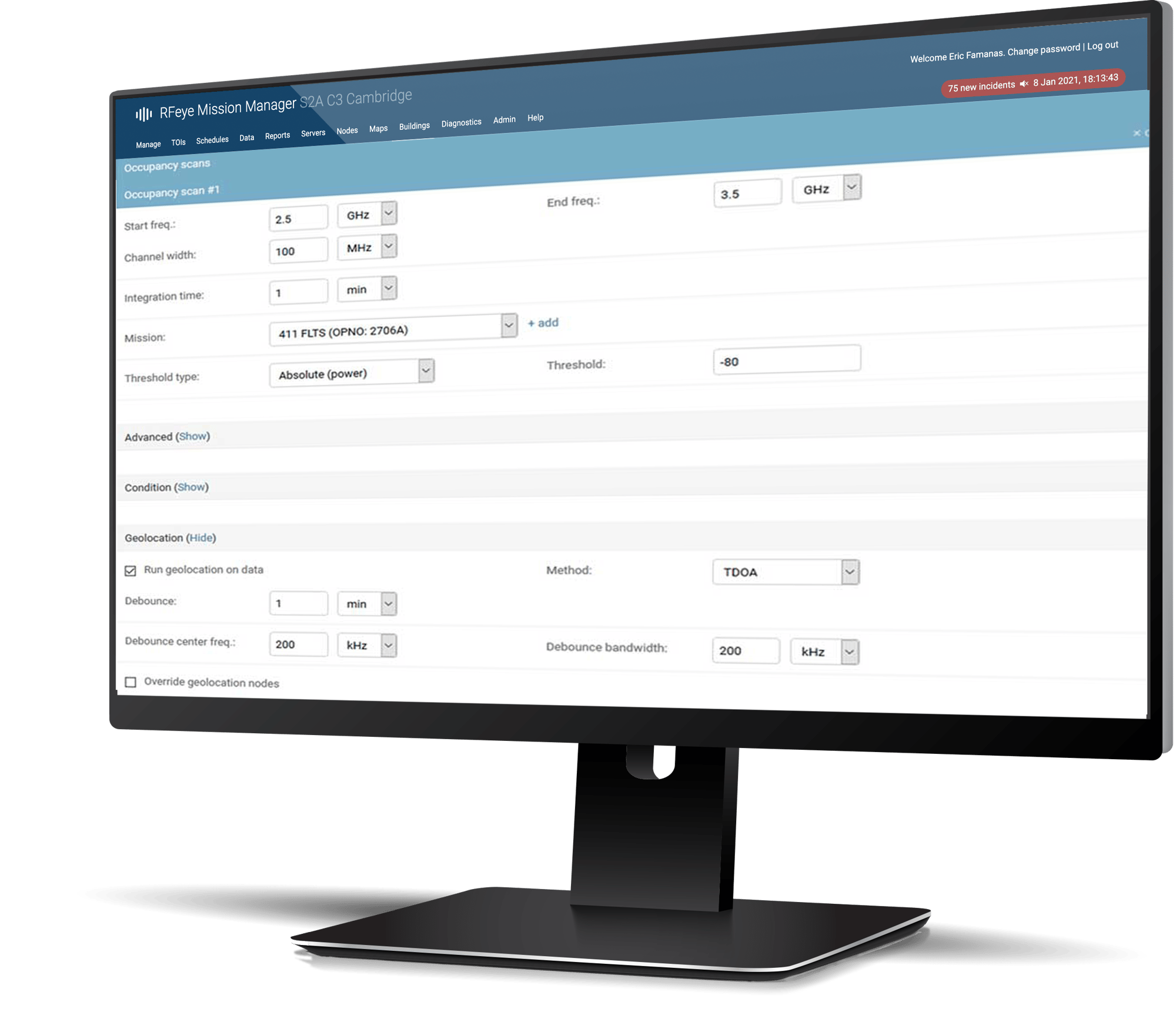
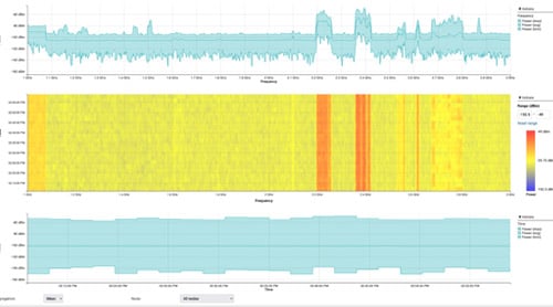
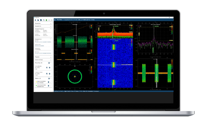
Mission Manager is a virtual spectrum manager, enabling users to establish and coordinate multiple scan operations, including sweep, occupancy, time, bearing, detector, and remote recording. Additionally, it permits sweep and interlinked surveys to form a command center from a central location. Software users can build a continuous and synchronous view of the spectrum as events happen.
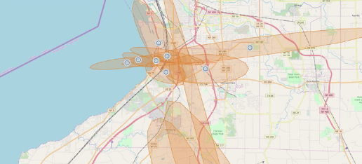
Automated geolocations
Intuitive visualization
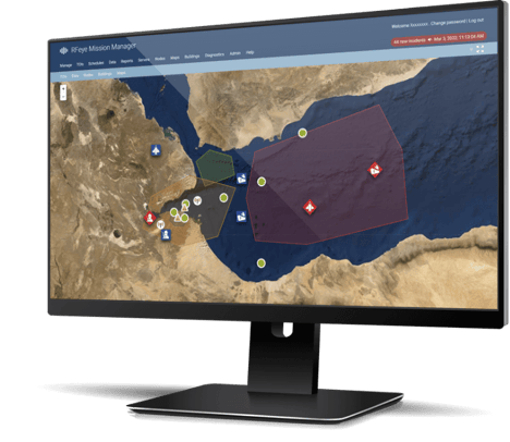
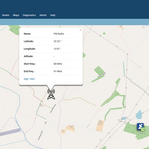
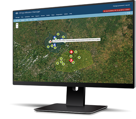
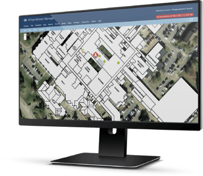
The map view feature provides an intuitive and straightforward graphical representation of the RF environment and complex datasets. Visualization allows users to monitor authorized transmitters, establish and monitor operating zones and geofences, and apply map overlays. Users can identify transmitters of interest (ToI) and grouped ToIs, access spectrum view, pinpoint geolocations, and receive incident reports and alarms in near time.


Schedule management
Automated reporting
Automatically generate many standard and customized reports and data captures, including signal occupancy reports, signal power reports, geolocation reports, sweep data, GPS status, and RF sensor reports. Distribute reports to authorized parties and send notifications as part of a report or schedule.
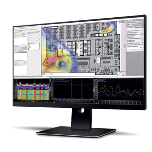
Supports TSCM (in-building spectrum monitoring)
PRODUCT BROCHURE
Schedule & automate spectrum monitoring in multi-user environments
For the best performance we recommend these specifications:
- Linux (Ubuntu) 20.04 (64-bit)
- Core CPU minimum, Intel Core i9 CPU recommended
- Memory: 32 GB RAM recommended (more for exporting / importing large datasets)
- SSD with at least 1 TB of free space (4 TB SSD recommended)
Talk to a software advisor
Whether you're an existing customer or an integrator wanting to discuss a program, our advisors are on-hand to discuss how our software solutions can be tailored to suit your needs.