CRFS unveils RFeye AirDefense

Passive long-range 3D tracking of aircraft, UAS & missiles
CRFS, a global leader in RF spectrum monitoring, management and geolocation solutions, prepares to unveil its passive 3D airborne tracking system, RFeye AirDefense, at the 56th Annual AOC International Symposium & Convention in Washington DC, October 28-30.
Developed to passively detect and geolocate airborne targets using their RF transmissions, RFeye AirDefense provides militaries with covert surveillance of their airspace for situational awareness, silently augmenting existing Integrated Air Defense Systems (IADS).
Both military and civilian aircraft transmit RF signals for voice communication, navigation, tactical data links and radar. The RFeye AirDefense system uses these transmissions to accurately detect the signal, locate its position in three dimensions and determine the probable flight path for individual aircraft, independent of the number that may be operating in the area.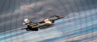
“The practical advantage of RFeye AirDefense is its ability to detect hostile aircraft and UAS without them being aware they are being tracked,” said Marty Mosier, CRFS Inc. General Manager. “This can provide essential covert intelligence on enemy activity and also augment radar systems by providing a long-range warning of incoming threats to enable radar cuing or provide coverage overlap.”
Mosier continued, “The ability to derive course, speed, and altitude from a geolocated signal of interest is often considered the holy grail of the airborne SIGINT community. Just from these pieces of data, we can help analysts determine the origin, platform type, bearing to estimated target and even intent.”
RFeye AirDefense uses a ground-based network of intelligent RFeye receivers linked to management and geolocation software to enable real-time monitoring and tracking of airborne targets over an extremely wide airspace. The same network and sensors can also provide general RF environment situational awareness and terrestrial emitter geolocation.
“Using our four-sensor test network in Buffalo, New York, we can, accurately geolocate and track multiple aircraft simultaneously at distances of hundreds of kilometers. It can track aircraft from stationary to speeds in excess of Mach 1,” said Mosier. “The system is expandable to any number of sensors to cover as large a geographic area as desired and can be managed and monitored in real-time from anywhere in the world.”
The system can be used for standalone situational awareness or as an integrated element in a system of systems for complete air defense. Applications range from operational in-theatre use to training and testing.
- end-
About CRFS
CRFS creates deployable systems to detect, identify and geolocate signals in complex RF environments. We provide end-to-end automated solutions for spectrum management and deconfliction, interference hunting and threat detection, using our intelligent receiver technology, software and advanced analytics. Our RFeye systems are widely deployed by military, intelligence, law enforcement and regulatory agencies.
CRFS designs, builds, programs and deploys systems and solutions from their production facilities in the UK and USA. We also have a network of trusted international partners that provide local support to our global customer base.
Media Assets

Watch the webinar
HOW TO RECORD AND EXTRACT SIGNALS FROM BIG RF DATA
Watch the webinar to learn how to improve your RF data recording process and unleash the full potential of your spectrum monitoring system.