
RFeye technology
Signal Discovery for RFeye Site: Discover hidden signals in real time
By Jaimie Brzezinski / 18.12.2025
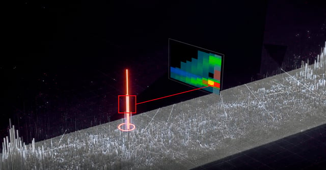
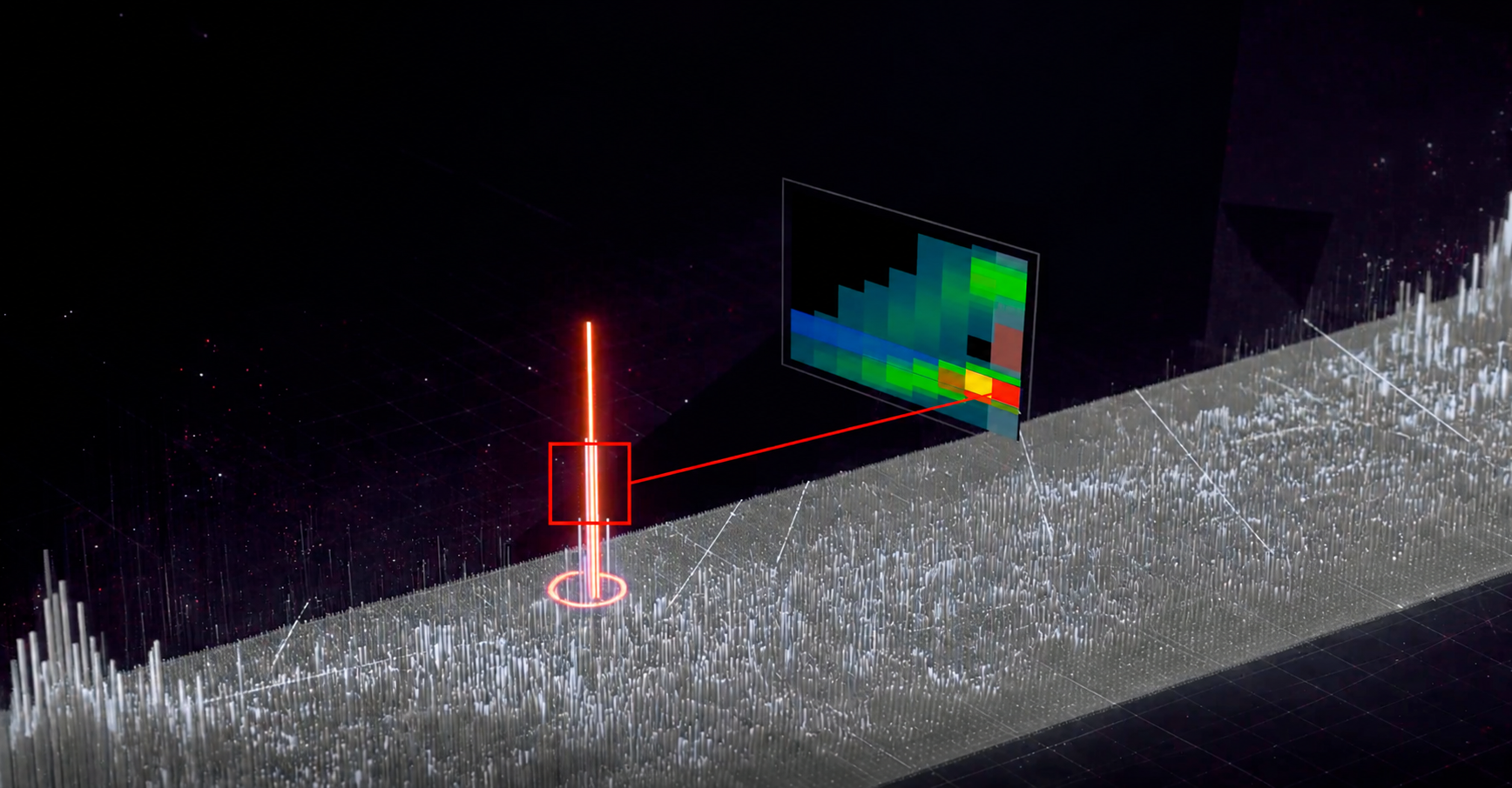
Introducing three significant updates that together will transform RFeye operators’ ability to plan, deconflict, manoeuvre, and execute EMSO missions in heavily contested radio frequency (RF) environments.
1. RFeye Site Signal Discovery
A new RFeye detector – instantly find and turn unknown RF signals into actionable data.
2. Wideband Geolocation Scan
Transforms a single wideband capture into 50+ real-time 2D/3D TDoA geolocations per second.
3. RFeye Core v2.25.5
An enterprise-grade, defence-ready software solution – not a lab tool. It unlocks our new and most powerful EMSO tools.
This feature solves critical, longstanding bottlenecks in RF spectrum monitoring and SIGINT:
Legacy spectrum tools rely on rigid, predefined signal libraries or basic power-mask triggers. If an adversary modifies a drone datalink, uses an uncatalogued SDR waveform, or transmits a short LPI burst, traditional systems fail completely. Operators are forced to record terabytes of raw I/Q data and spend hours using post-processing tools to write customised detector scripts — by which time the tactical window has closed.
Transforming a single wideband capture into 50+ real-time 2D/3D TDoA geolocations per second is revolutionary because it collapses targeting timelines to support unprecedented spectrum superiority in dense, fast-hopping threat environments.
|
“We’re getting an order of magnitude more real-time signal geolocations per second from the same systems. Knowing the location of every single signal is a paradigm shift. It provides an invaluable source of real-time location intelligence to direct further missions.” Battle-proven military EW operator (beta tester) |
Operators would previously set up each TDoA geolocation task individually for multiple signal channels, with each task consuming its own system resources. We have scaled this capability to support more simultaneous signal geolocations at greater speed.
Alongside its new capabilities, RFeye Core v2.25.5 strengthens security, performance and operational reliability.
Updated application platform: Migration to .NET 10 improves runtime performance and memory management. Charting has also been upgraded.
Security hardening: Vulnerabilities identified through application security testing have been addressed.
Performance and stability: CPU and memory usage during long-running sessions have been improved, with memory released more effectively when solutions are stopped.
Automatic bearing correction: Operators can select True North, Magnetic North or Automatic (GPS) as the antenna pointing reference. When Magnetic North is selected, the WMM2025 geomagnetic model calculates declination correction based on the node’s position.
Upgrade recovery: Saving a solution also creates a copy in the previous format, providing a recovery option during upgrades.
Example signals that can be detected
|
|
Pain point: |
Tactical environments are crowded. Adversaries use LPI radars and frequency-hopping radios. Standard systems miss them or take too long to scan vast bands channel-by-channel. |
|
Solution: |
Signal Discovery spots anomalies, while Wideband Geolocation Scan allows operators to monitor known emitters and search busy bands for new activity simultaneously, giving commanders broad situational awareness without sacrificing geolocation accuracy. The new TDoA Optimisation Control lets operators in fast-moving tactical situations prioritise speed, while intelligence analysts in deliberate operations can prioritise accuracy — all from the same system. With node baselines now supported up to 10,000 km, the same capability scales from a forward operating base to a theatre-wide SIGINT architecture. |
|
Pain point: |
In contested environments, Allied forces need to find and locate hostile LPI radars and tactical mobile radios by monitoring multiple communications channels simultaneously. |
|
Solution: |
Using the Wideband Geolocation Scan, the operator defines their channel groups and the RFeye system automatically takes wideband captures and correlates across all targets at once. Using detector gating, it skips empty spectrum, instantly delivering 3D (latitude, longitude, altitude) locations for each signal. By optimising resources, it geolocates many tens of different signals per second, tracking locations or distinguishing between multiple similar signals. |
|
Border Security Monitoring and C-UAS |
|
|
Pain point: |
Drones operate in 2.4 GHz or 5 GHz bands saturated with civilian Wi-Fi. Power triggers cause constant false alarms, and standard libraries miss modified drones. |
|
Solution: |
Operators use Signal Discovery visual filters on the heatmap to exclude Wi-Fi and isolate the drone’s pulse pattern, quickly geolocating the drone and its pilot. Wideband Geolocation Scan then provides rapid geolocations of similar targets in the same geographic region, distinguishing between multiple targets using the same radio signals. |
|
Time-sensitive location / targeting operators in complex environments |
|
|
Pain point: |
Locating a signal can take too long, and with multiple simultaneous signals, conventional processing within other detection systems can fail. |
|
Solution: |
Using Geolocation Scan, we can geolocate significantly more signals (over 50) per second in 2D or 3D space. When signals appear in regions of interest, whether a single signal or larger numbers of similar signals, you want to know about them fast. Geolocation Scan provides this. |
An RFeye spokesperson said, “This EMSO capability has been requested by military and commercial customers and has been delivered as part of our continued investment roadmap. The software has been battle-tested and is already in service in fiercely contested environments. It is now being rolled out to all RFeye Software Support and Upgrade Service 2 customers worldwide. It reinforces the importance of detection based on physical RF characteristics, rather than relying on signal libraries. It leverages powerful detection at the edge on 100 MHz IBW RFeye Nodes – processing massive amounts of spectrum from a single capture efficiently. It’s an important response for military and commercial operators managing modern, challenging and evolving signal threats. It’s also an enterprise-grade, defence-ready software solution – not a lab tool.”
Brochures & guides
Discover how RFeye Signal Discovery and Wideband Geolocation Scan help operators detect unknown signals, reduce manual analysis, and turn complex RF activity into actionable location intelligence.
Join thousands of professionals who subscribe for exclusive insights and early access to our reports and analysis.