Huge expanses of ocean are one of the world’s most demanding environments to conduct maritime surveillance: thousands of islands, vast exclusive economic zones (EEZs), congested shipping lanes, and remote coastlines create challenges for the navies and coast guards responsible for protecting national interests.
Also, the nature of maritime competition is changing.
Rather than being one single, identifiable event, today’s security challenges include activities such as illegal fishing fleets, smuggling networks, unregistered vessels, unmanned systems, and electronic interference. The objective is frequently not to trigger a national response, but to create ambiguity, complicate decision-making, and degrade a nation’s control over time.
To counter this, maritime surveillance must shift from crewed platform-centric patrols towards persistent, distributed sensing.
The ISR challenge
Maintaining persistent surveillance across large maritime areas has historically been difficult and costly.
Maritime patrol aircraft and vessels provide valuable capability, but they are constrained by operating costs, endurance, maintenance cycles, and competing operational priorities.
Fixed coastal sensor networks can provide long-term surveillance of critical infrastructure, ports, and major shipping routes. However, every fixed sensor is limited by geography, line-of- sight, and the radio horizon.
To counter modern threats, commanders require persistent, flexible, and low-cost surveillance systems without these constraints.
Extend the sensor network
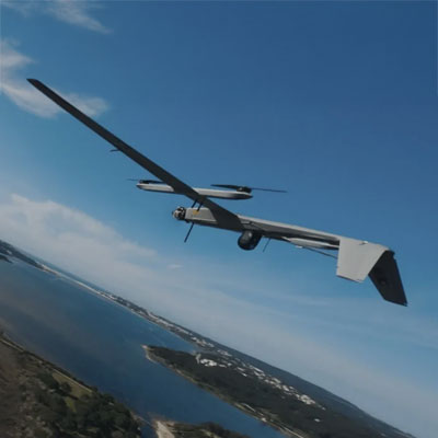
One approach is to integrate passive RF sensing payloads onto long-endurance unmanned aerial vehicles (UAVs).
UAVs act as mobile extensions of the wider sensor network. They can be launched from airfields, naval vessels, or unprepared strips on remote island locations to expand surveillance into areas where permanent infrastructure would be impractical and manned surveillance could be risky and expensive.
Operating at altitude dramatically extends the radio horizon. One single UAV carrying a passive RF sensor to monitor a significantly larger area than an equivalent ground-based installation. By adjusting flight paths, operators can reposition coverage as operational priorities change, creating a flexible ISR capability that complements deployed maritime assets. This concept enables commanders to concentrate sensing capability where it is needed.
Looking beyond the visible picture
EO/IR sensors and radar are fundamental to maritime surveillance, but they cannot always reveal the full operational picture. RFeye Nodes extend the sensor network beyond the visible spectrum. Rather than relying solely on what operators can see, they detect and geolocate electromagnetic emissions from communications systems, navigation equipment, radar, and unmanned platforms.
This enables commanders to understand activity even when targets are beyond visual range, operating at night, or attempting to avoid detection.
However, the real advantage is not simply detecting vessels, but understanding their behaviour. Communications links, radar emissions, navigation systems, and drone control links reveal patterns of activity that help distinguish routine operations from threats.
When multiple RFeye Nodes detect the same transmission, specialist software can accurately geolocate the emitter. This information can then be fused with EO/IR, radar, AIS, and other data sources to provide commanders with a more accurate understanding of the maritime environment.
Supporting faster operational decisions
Rather than maintaining continuous patrols across every area of interest, commanders can monitor wide areas using RF sensors integrated into UAVs to identify unusual electromagnetic activity. Distributed RF sensing does not just mean more data; it can increase the speed that decisions are made.
Patrol vessels or aircraft can then be deployed when necessary.
This approach enables finite resources to be used more efficiently while providing early warning threat detection.
RFeye Nodes process data on the edge, transmitting only relevant data back to command centres. This reduces communications bandwidth and allows sensor networks to operate effectively even where connectivity is constrained.
Building a resilient maritime surveillance architecture
No single platform can provide comprehensive maritime domain awareness. Instead, future surveillance architectures will combine fixed coastal infrastructure, maritime patrol aircraft and vessels, autonomous surface vessels, and UAVs into a layered, distributed sensing network.
Within this architecture, RFeye Nodes integrated onto UAVs provide a flexible means of extending ISR capabilities.
Strengthening maritime domain awareness does not have to mean deploying more patrols or collecting more data. It can be about giving commanders greater decision space. Earlier warning, a better understanding of intent, and the ability to position the right assets where they are needed before an incident develops enable maritime forces to retain the operational initiative.